Open House Melbourne 2024
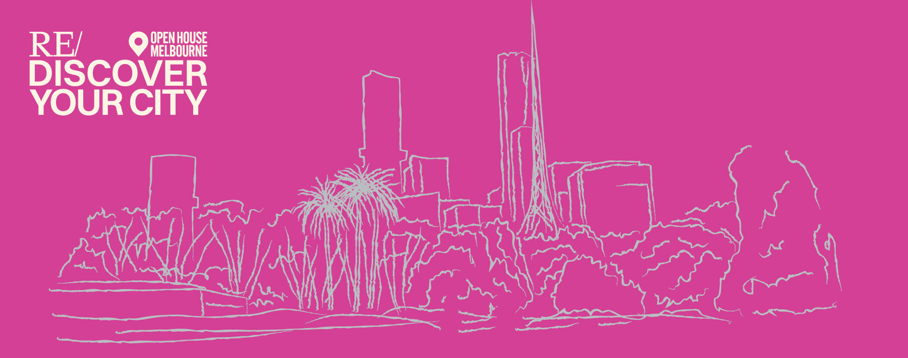
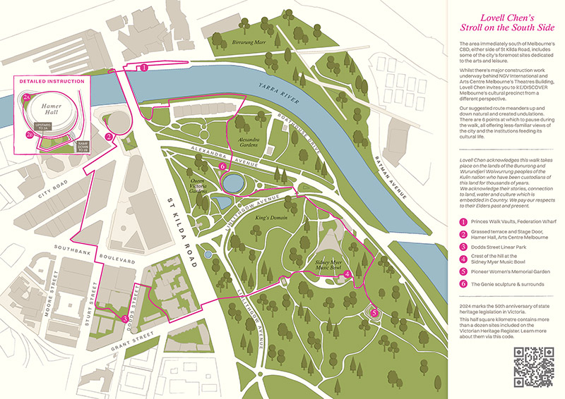
Open House Melbourne 2024 has arrived! This year we have created the self-guided walk — A Stroll on the South Side. The area immediately south of Melbourne’s CBD, either side of St Kilda Road, includes some of the city’s foremost sites dedicated to the arts and leisure.
While there’s major construction work underway behind NGV International and Arts Centre Melbourne’s Theatres Building, Lovell Chen invites you to RE/DISCOVER the Melbourne Arts Precinct from a different perspective — using our map.
Our suggested route meanders up and down natural and created undulations…
— from an almost private roof garden at the Arts Centre granting unencumbered 180 degree views
— to the bunkered performers’ entrance of a burrowed concert hall;
— from gazing out, eye-level with Rod Laver Arena’s retractable roof
— to edging carefully by the surface of the Birrarung (Yarra River).
There are six points at which to pause during the walk, all offering less-familiar views of the city and the institutions feeding its cultural life.
OPEN HOUSE MELBOURNE : Saturday 27 + Sunday 28 July 2024
MAP WITH SUGGESTED ROUTE (approx 1.5 – 2 hours) available all weekend
FROM : Open House Melbourne Info Hub, outside Melbourne Town Hall, Swanston Street
OR : Download map now >
So, get yourself a map — and stroll away!
0 | Introduction
The half square kilometre covered by our Melbourne Arts Precinct map contains more than a dozen sites that are included in the Victorian Heritage Database.
This might cause you to think that it’s an area protected to the point of being frozen. But just as artists and the Arts absorb and reflect earlier movements while continually evolving, so does the urban landscape evolve.
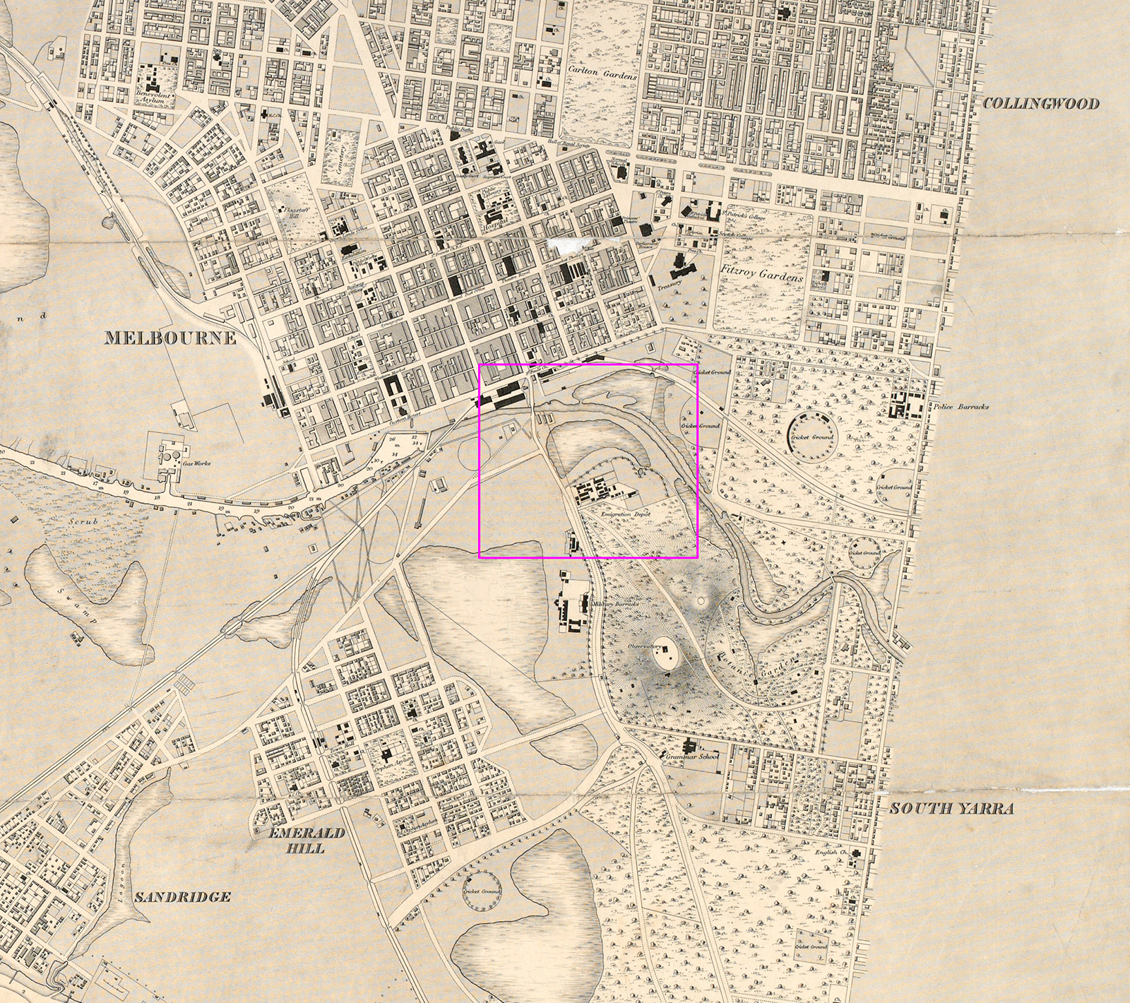
On this excerpt of an 1865 map, we’ve marked the roughly equivalent area of the Stroll. Zooming in on the detail will help you understand how extensively the low lying swampland either side of the Birrarung (Yarra) was modified in the later decades of the 19th century, as well as indicating some previous uses of the area.
If you’d like to know more about what you’re seeing as you progress through the Stroll’s six stages, we suggest the following images and links as jumping off points.
map : Victoria-Australia, Port Phillip. Hobson Bay and River Yarra leading to Melbourne (detail), Henry Laird Cox, 1865
courtesy State Library of Victoria
1 | Princes Walk Vaults, Federation Wharf
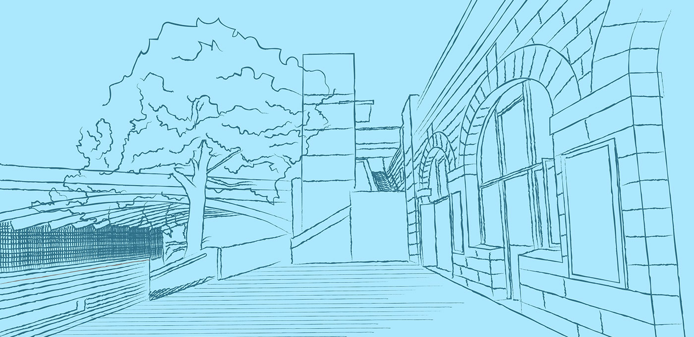
A series of stepped and inclined paths lead down from the bustle of Federation Square to the water’s edge. Since 1890, twenty barrel-vaulted brick cells faced in Malmsbury basalt have both enabled a means of crossing, and held the city back from, the Birrarung (Yarra).
Constructed to support an eastern approach to Princes Bridge/Swanston Street, until 1998 the vaults supported the four-lane route of Batman Avenue and a tram terminus. The vaults have been used as Melbourne City Council storerooms, an architectural office, and by various businesses associated with recreational river transport.

The current City of Melbourne Greenline Project is aimed at improving our connection with the river. To continue to follow the map, make sure you go under Princes Bridge to reach the other side of St Kilda Road.
Victorian Heritage Database … Princes Walk Vaults | Flinders Street Railway Station | St Kilda Road | Princes Bridge | Federation Square
top : Panoramic view of the city of Melbourne … (detail), Laurence William Wilson, 1905
courtesy State Library of Victoria : link to image
bottom : City skyline across the Yarra, Rose Stereograph c1920-54
courtesy State Library of Victoria : link to image
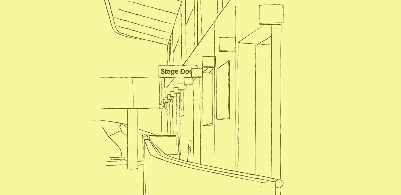
2 | Grassed Terrace and Stage Door, Hamer Hall
It’s common to cross Princes Bridge by tram, car or bike — and if you’re heading to a performance or exhibition, chances are you’re hurrying to meet people in the foyer. Today is not about taking the most direct route. We invite you to veer just a little beyond the M, A and B roads and peek behind the major sites.
Step away from the crowd, up onto the grass and beyond to Hamer Hall’s circular balcony where your reward is an almost-private urban panorama.

Hamer Hall is part of Arts Centre Melbourne. It was designed by architect Sir Roy Grounds and completed in 1982. Originally named Melbourne Concert Hall, it became Hamer Hall in 2004 following the death of former State Premier Sir Rupert Hamer. The hall was originally intended to be primarily underground and as you descend from the terrace to the performers’ entrance, you still get a real sense of burrowing down.
Victorian Heritage Database … Victorian Arts Centre | Forward Surge
top : The Concert Hall under construction in 1981, looking north
courtesy Australian Performing Arts Collection, Arts Centre Melbourne : link to image
bottom : Aerial view in 1990
courtesy Australian Performing Arts Collection, Arts Centre Melbourne : link to image
3 | Dodds Street Linear Park
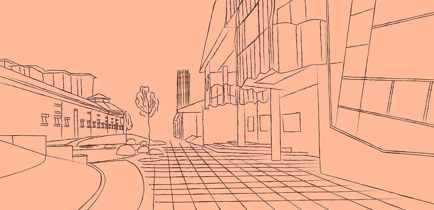
Where Dodds Street previously operated as a thoroughfare between creative institutions, you’ll now find a completely transformed space where the heritage bricks of the adjacent old stables building bleed into new paved pathways; bluestone spheres emerge from the ground plane; and amphitheatre seating provides a space to gather, perform or rest.
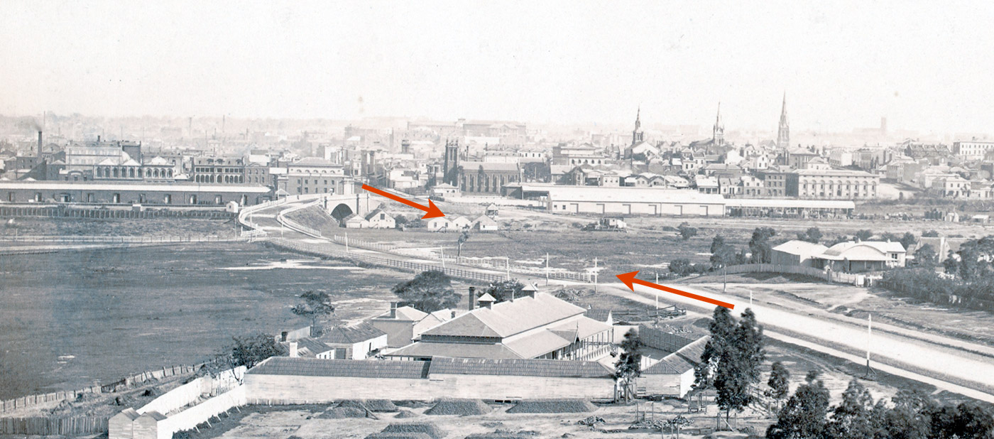
The top photo is an early view looking north. The red arrows indicate the eventual route of St Kilda Road and the present Princes Bridge. The original bridge is visible to the left of the top arrow. The second photo is looking east across South Melbourne to the Domain in 1945. The red line indicates Dodds Street, running beside the former Victoria Police stables.
A City of Melbourne project … more information >
Victorian Heritage Database … National Gallery of Victoria | Former Victoria Police Depot | The Vault (sculpture)
top : Melbourne from the military barracks (detail), Charles Nettleton (1862-79)
courtesy State Library of Victoria : link to image
bottom : South Melbourne (detail), Charles Daniel Pratt, 1945
courtesy State Library of Victoria : link to image
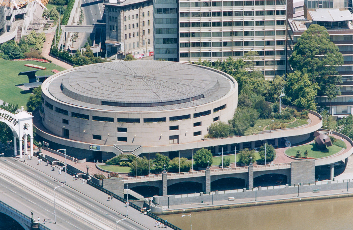
4 | Crest of the hill at Sidney Myer Music Bowl
The Domain Parklands are on the traditional lands of the Bunurong and Wurundjeri Woiwurrung peoples of the Kulin nation and have long been an important gathering place. Extensive earthworks were carried out to create this amphitheatre in 1958-1959, with a slope providing views to the sound shell and excavated soil used to create sound deflecting banks on either side.
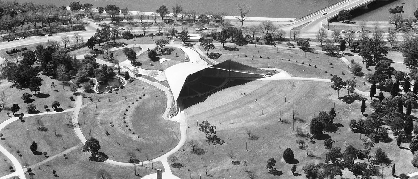
The top photo shows the view from the tower of Government House in 1886-87. Note the circus tents at far left. The lower photo is an aerial view of Sidney Myer Music Bowl taken soon after its completion. The Music Bowl is a tensile structure. The construction system consists of a cable net supported by pylons, and covered in aluminium-faced plywood panels. It was completed in 1959, under project architect Barry Patten of Yuncken, Freeman, Griffiths and Simpson.
Victorian Heritage Database … Sidney Myer Music Bowl | Domain Parklands | Boer War Memorial
top : View of Melbourne rom Government House, Charles Rudd, 1886-87
courtesy State Library of Victoria : link to image
bottom : Aerial view of construction, taken circa 1955-60 by Jim Payens
courtesy Museums Victoria : link to image
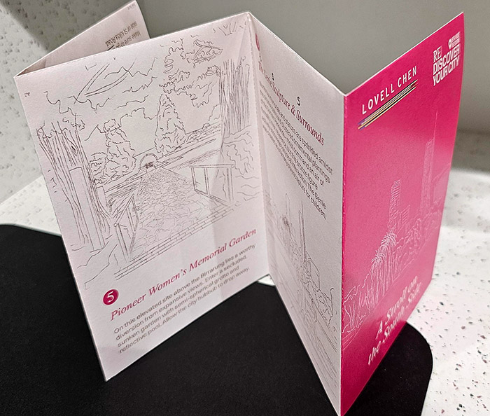
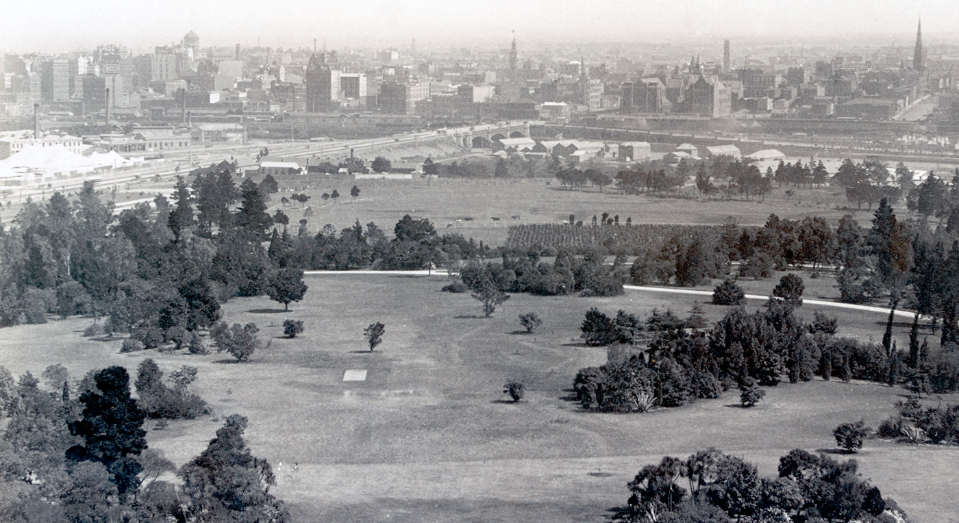
5 | Pioneer Women’s Memorial Garden
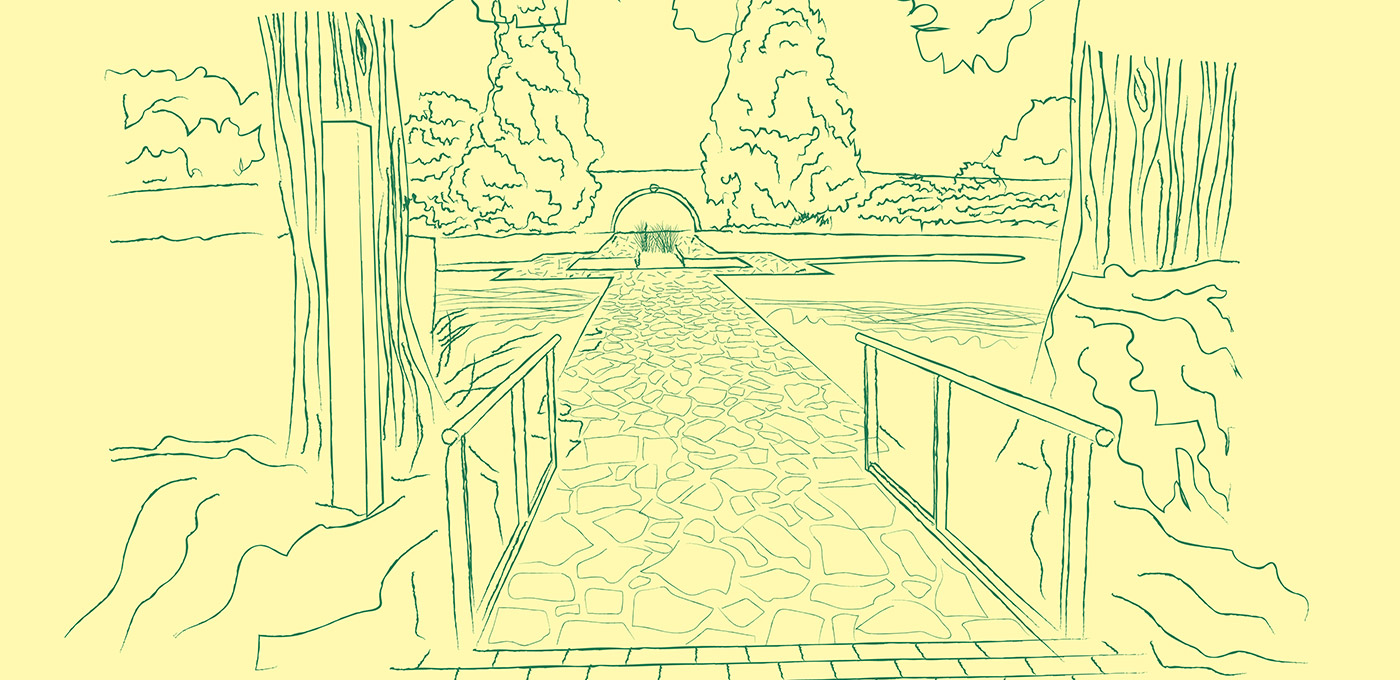
On an elevated site in Domain Parklands above the Birrarung (Yarra) lies a worthy diversion from expansive views. Enter a secluded, sunken garden with semi-spherical grotto and a reflecting pool. Allow the city hubbub to drop away.
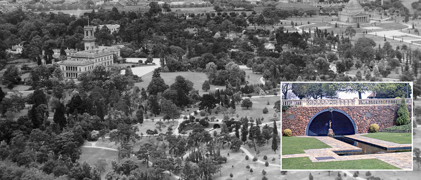
The main photo is an aerial view of the King’s Domain taken circa 1940s. The Pioneer Women’s Memorial Garden can be seen in the centre. The inset photo shows the grotto and reflecting pool — details that are now partly obscured by mature plantings. The Domain, including the Memorial Garden which commemorates the State’s pioneer women and was constructed as part of Melbourne’s Centenary celebrations (1935), was designed by Hugh Linaker.
Victorian Heritage Database … Domain Parklands incl. King’s Domain Pioneer Women’s Memorial Garden, Stapley Pavilion, Floral Clock, and more
main : King’s Domain, looking south in the 1940s, with Government House at left (detail)
courtesy City of Melbourne Art and Heritage collection : link to image
inset : Pioneer Women’sMemorial, Alan Bates, 1963
courtesy City of Melbourne Art and Heritage collection : link to image
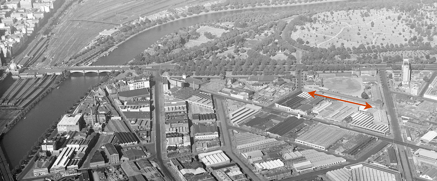
6 | The Genie Sculpture and its surroundings
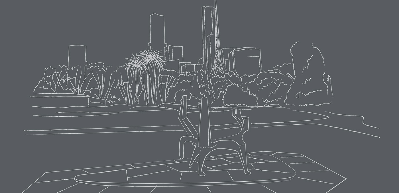
Numerous memorials and statues are sprinkled amidst the sinuous paths and clustered ornamental plantings of the Domain Parklands. Most command an air of formality, even reverence, but the bronze figure of The Genie actively encourages physical interaction. Its location is indicated on the second photo.
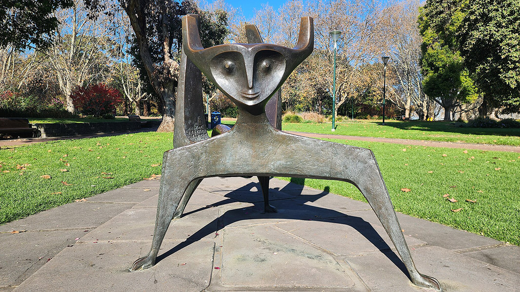
About The Genie … Created in bronze by Tom Bass as the result of a commission by the City of Melbourne. It was installed in Domain Parklands in 1973. It was created as a fantasy play sculpture for children — a purpose suited to its location, where the Arts Precinct starts to blend into the more northerly Sports Precinct.
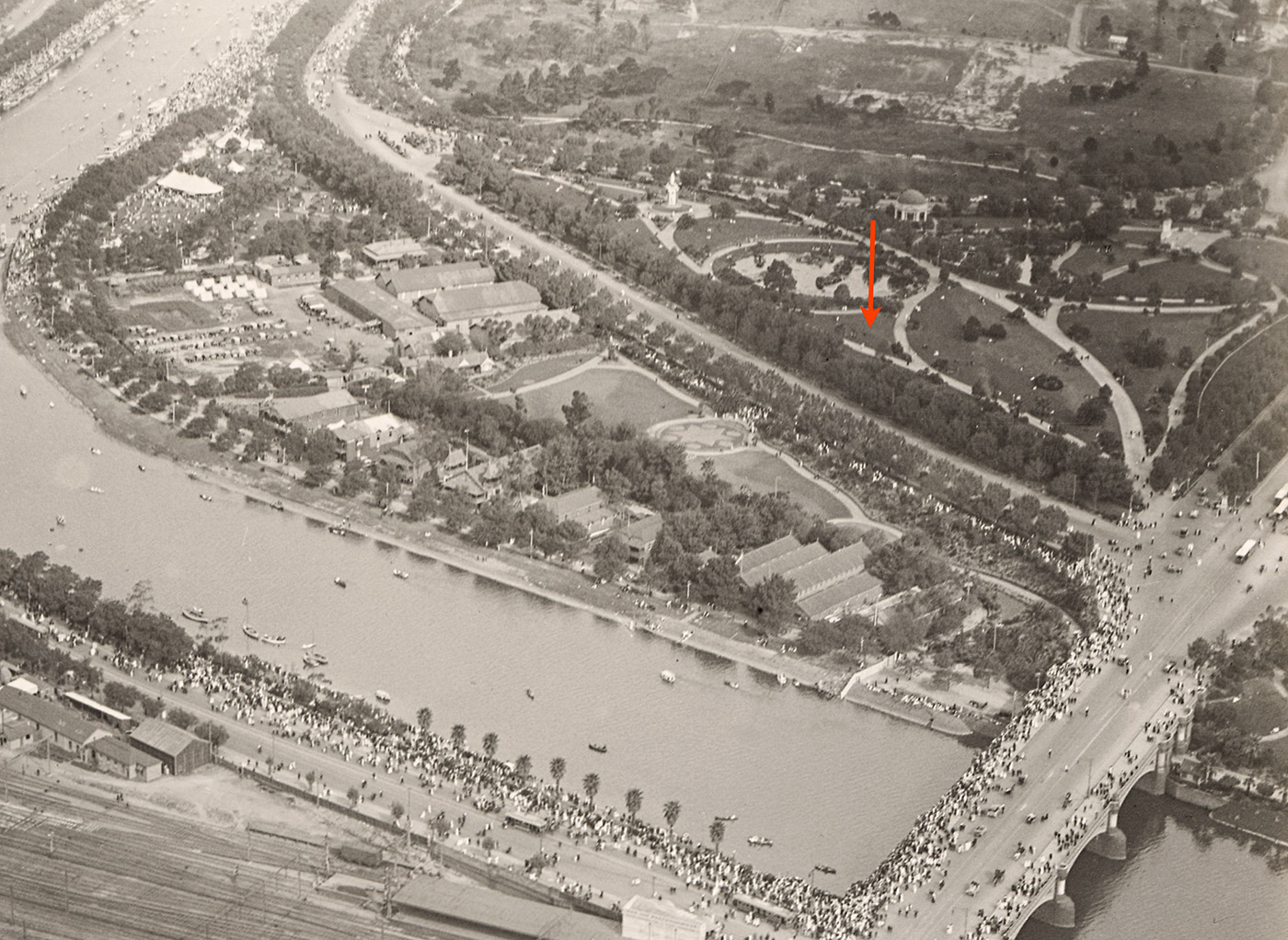
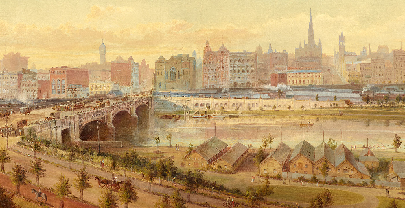
This photo dates from 1926, most likely Saturday 23 October, when the hugely popular Australian Henley Regatta was held. At that time, a story in The Argus newspaper described this final leg of the walk in this way: “… both banks for a long mile on either side of the course were so thickly peopled that moving became difficult …”
“There was one scene on Saturday afternoon that was unforgettable, when the broad stretch of the river was splashed with the massed colour of the slowly moving small craft coming down singly or in groups; both banks one mass of humanity, rainbow tinted and never for a moment still, while overhead in the unflecked blue sky three aeroplanes, like gigantic dragon flies, droned to and fro … It was such a scene that drove home the truth that the Yarra, the once ugly duckling of the rivers of the State, with its lawns to the water’s edge and tree-fringed banks, has grown into a swan, for there is no more beautiful promenade in Melbourne, nor perhaps in any other city in Australia, than the south bank of the river [as it] is to-day.”
Victorian Heritage Database … Domain Parklands | Queen Victoria Memorial | St Kilda Road | Melbourne University Boat Club Shed
top : The Genie by Tom Bass photographed in 2024
courtesy Shkuru Afshar, CC BY-SA 4.0, via Wikimedia Commons
bottom : Above Flinders Street Railway Station looking towards South Yarra, Ernest Ebell, 1926
courtesy State Library of Victoria : link to image
Lovell Chen acknowledges that this tour takes place on the lands of the Bunurong and Wurundjeri Woiwurrung peoples of the Kulin nation, who have been custodians of this land for thousands of years. We acknowledge their stories, and connection to land, water and culture, which is embedded in Country. We pay our respects to their elders past and present.
The map
Self-guided walking route (approx 1.5 – 2 hours).